


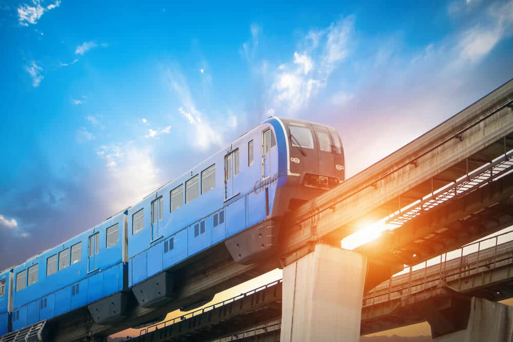
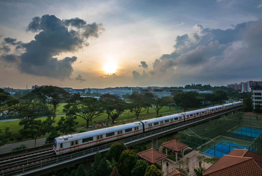
Singapore’s MRT system is crucial to the city’s public transport network, providing efficient and reliable transportation for its residents and visitors.
With its clean and comfortable trains, convenient station locations, and high frequency of service, the MRT system offers a pleasant and convenient way to travel around the island.
Over the years, the MRT network has expanded, covering more areas and improving connectivity.
Future MRT maps, such as the Cross Island Line and the Thomson-East Coast Line, will further enhance the MRT system and cater to the growing transportation demands.
Get ready to explore the fascinating world of Singapore’s MRT system and discover how it shapes the city’s land transport infrastructure.
Key Takeaways
| Topic | Key Takeaway |
|---|---|
| Singapore’s MRT System | The MRT system plays a pivotal role in Singapore’s public transport network, providing efficient and reliable transportation. |
| Evolution of Singapore’s MRT | The MRT network has expanded over the years, with new lines and extensions, covering more areas and improving connectivity. |
| Key Features and Benefits | The MRT system offers efficiency, reliability, cleanliness, comfort, and convenient access to various areas across Singapore. |
| Current and Future MRT Lines | Singapore has existing MRT lines connecting different parts of the island, with planned expansions to meet growing demands. |
| Cross Island Line | The Cross Island Line will connect the east and west, improving connectivity and reducing travel time for commuters. |
| Downtown Line | The Downtown Line connects the east and west, providing convenient access to key destinations and integrating with other lines. |
| Jurong Region Line | The Jurong Region Line enhances connectivity in the west, connecting residential and commercial areas, and improving accessibility. |
| Circle Line | The Circle Line connects major lines, has several interchange stations, and is planned for future extensions to enhance connectivity. |
| Thomson-East Coast Line | The Thomson-East Coast Line connects the north and east, improving accessibility, reducing travel time, and accommodating growth. |
| East-West Line | The East-West Line is the first MRT line, has undergone expansions and improvements, and will continue to serve as a vital backbone. |
| Future MRT Lines | Singapore has planned future MRT lines and expansions to improve accessibility, reduce travel time, and meet transportation needs. |
| Architecture and Design | Singapore’s MRT stations feature modern and efficient designs, integrate art and culture, and provide accessibility for all. |
| Fully Automated and Driverless MRT | The future of rail transport in Singapore involves fully automated and driverless MRT systems, offering increased efficiency and safety. |
| Rail Network Connectivity | Singapore’s rail network is expanding, improving connectivity between different regions, and integrating various modes of transportation. |
| Land Transport Authority’s Vision | The Land Transport Authority aims to improve connectivity, efficiency, and engage the community to create a comprehensive transport network. |
Introduction to Singapore’s MRT System
Understanding the Importance of MRT in Singapore’s Public Transport Network
The Mass Rapid Transit (MRT) system in Singapore is pivotal in the city-state’s public transport network.
With a land area of just over 700 square kilometers and a population of more than 5.
7 million people, Singapore needs an efficient and reliable transportation system to cater to the needs of its residents and visitors.
The MRT system provides a convenient and sustainable mode of transport, reducing road congestion and offering commuters a faster and more comfortable way to travel around the island.
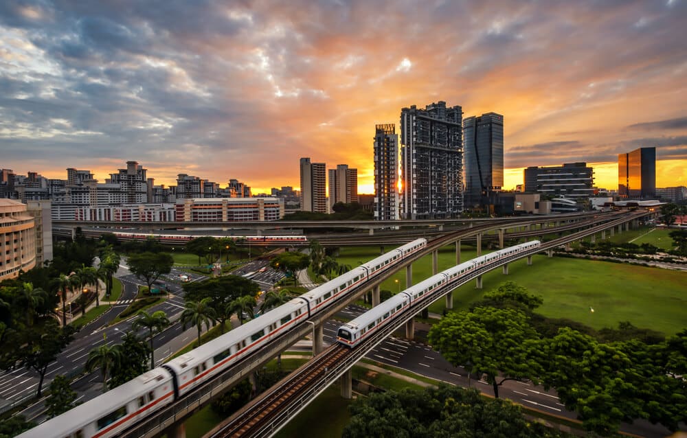
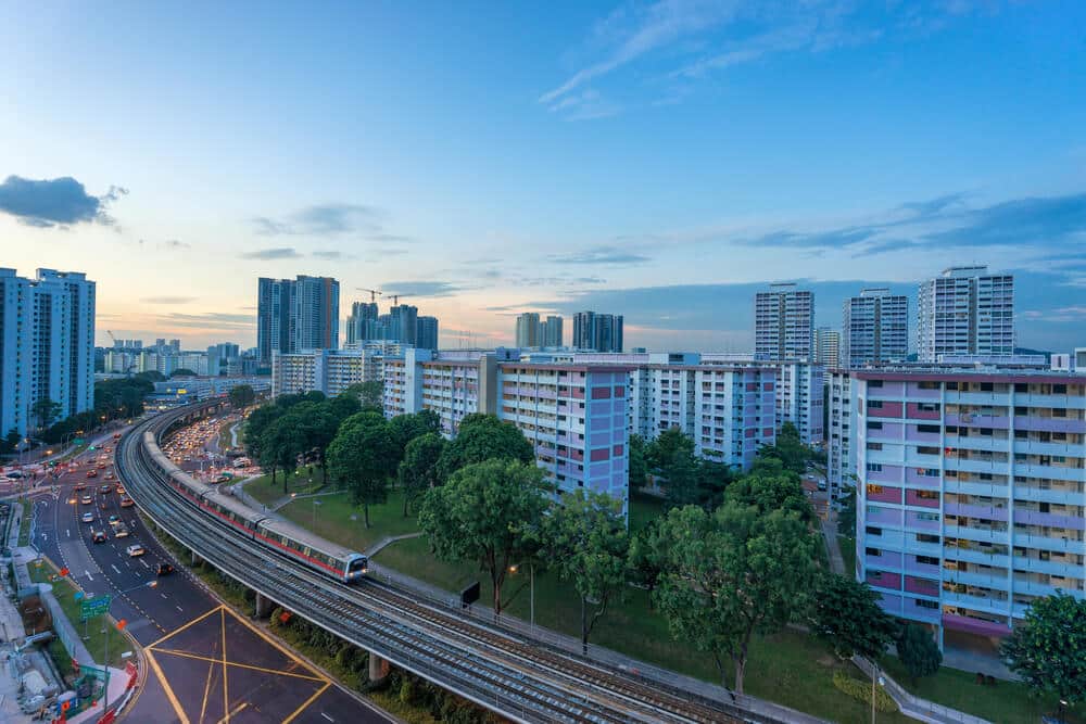
Exploring the Evolution of Singapore’s MRT Network
The development of Singapore’s MRT network has been an ongoing process since the first line, the North-South Line, opened in 1987.
Over the years, the system has expanded with new lines and extensions to existing ones, gradually covering more areas of the island.
The Land Transport Authority (LTA) has been actively involved in planning and implementing the MRT system, continuously improving and upgrading it to meet the growing demands of Singapore’s transport infrastructure.
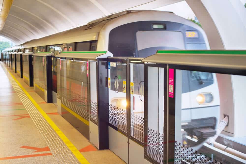
Key Features and Benefits of Singapore’s MRT System
The Singapore MRT system offers several key features and benefits that make it an essential part of the city-state’s public transport network.
One of the primary advantages is its efficiency and reliability.
The MRT system operates with high frequency, ensuring minimal commuter waiting times.
The trains are clean, comfortable, and equipped with modern amenities, providing a pleasant journey experience for passengers.
Moreover, the MRT stations are conveniently located, serving as access points to various residential, commercial, and leisure areas across Singapore.
Current and Future MRT Lines in Singapore
An Overview of the Existing MRT Lines in Singapore
Singapore currently has several MRT lines connecting different parts of the island.
The East-West Line, also known as the Green Line, runs from Pasir Ris in the east to Tuas Link in the west, providing a crucial connection between the two regions.
The North-South Line, or the Red Line, serves the northern and southern parts of Singapore, connecting areas such as Jurong East, Orchard, and Marina Bay.
The Circle Line, Downtown Line, and North-East Line further enhance the connectivity of the MRT system, offering commuters more options to travel within the city.
Upcoming MRT Lines: Meeting the Growing Transport Demands
In response to the growing transport demands, the Land Transport Authority has planned several upcoming MRT lines to expand the network further.
One of the highly anticipated projects is the Thomson-East Coast Line, which is set to open in stages starting in 2019.
This line will connect areas such as Woodlands, Caldecott, Marina Bay, and Bedok, providing direct access to key commercial and residential districts.
Another significant addition to the MRT system is the Jurong Region Line, which is expected to open by 2028, enhancing connectivity in the western part of Singapore.
Future Expansion Plans: 2030 MRT Map and Beyond
The future of Singapore’s MRT system looks promising with the unveiling of the 2030 MRT Map.
The map showcases the new lines and extensions planned to be completed by 2030.
Some of the future MRT lines include the Cross Island Line, Jurong Lake Line, and the North-South Corridor.
These lines will further improve connectivity across the island, offering commuters more options and reducing travel time.
With continuous development and expansion, the MRT system will continue to play a crucial role in Singapore’s land transport infrastructure.
The Significance of the Cross Island Line in Singapore’s Land Transport
Understanding the Purpose and Objectives of the Cross Island Line
The Cross Island Line is one of Singapore’s MRT network’s most significant upcoming projects.
It aims to connect the eastern and western parts of the island, improving connectivity and reducing travel time for commuters.
The line will be a critical link for residents living along the central corridor, providing them with direct access to significant employment and residential areas.
Additionally, the Cross Island Line will enhance connectivity to nature reserves, recreational spaces, and educational institutions, allowing residents to enjoy a higher quality of life.
Potential Impact on Travel Patterns and Connectivity
The implementation of the Cross Island Line will have a profound impact on travel patterns and connectivity in Singapore.
It will enable commuters to travel between the East and West more efficiently, reducing the need to rely heavily on other modes of transport.
With improved accessibility, areas along the Cross Island Line will experience increased economic growth and development.
Furthermore, the line will provide commuters with alternative routes and reduce overcrowding on existing MRT lines, ensuring a smoother and more comfortable commuting experience.
Addressing Environmental Concerns and Mitigation Measures
While the Cross Island Line brings many benefits, it raises environmental concerns due to its potential impact on nature reserves and green spaces.
The Land Transport Authority has taken measures to address these concerns and minimize the project’s ecological impact.
Extensive environmental assessments and surveys are being conducted to determine the best alignment for the line.
Mitigation measures such as wildlife crossings, ecological corridors, and noise insulation will be implemented to protect the existing ecosystem and wildlife habitats.
Exploring the Downtown Line and Its Impact on Commuters
Overview of the Downtown Line: Connecting the East and West
The Downtown Line is a crucial part of Singapore’s MRT network as it connects the eastern and western regions of the island.
The line stretches from Bukit Panjang in the west to Expo in the east, covering a distance of approximately 42 kilometers.
The Downtown Line integrates with other MRT lines, allowing commuters to transfer quickly and access various parts of the island.
It is a vital link for residents heading to key destinations such as the Central Business District, shopping malls, and entertainment hubs.
Benefits and Convenience for Commuters along the Downtown Line
Commuters along the Downtown Line enjoy several benefits and conveniences the MRT system provides.
The line reduces travel time and offers a comfortable journey experience with air-conditioned trains and spacious platforms.
With various station amenities such as escalators, lifts, and barrier-free access, the Downtown Line caters to the needs of commuters of all ages and abilities.
Additionally, the line connects densely populated residential areas, providing residents with quick and convenient access to schools, healthcare facilities, and recreational attractions.
Integration with Other MRT Lines and Transport Hubs
The Downtown Line seamlessly integrates with other MRT lines and transport hubs, enhancing connectivity and improving commuter travel options.
Interchanges with lines such as the Northeast, East-West, and Circle Lines allow commuters to transfer quickly and reach their destinations with minimal disruptions.
The line also connects to major transport hubs such as Bugis and Chinatown, where commuters can access other modes of transport, including buses and taxis.
Integrating the Downtown Line with other transport networks provides commuters with a seamless and efficient travel experience.
Jurong: A Key Hub in Singapore’s MRT Network
The Importance of Jurong as an Integrated Transport Node
Jurong, located in the western part of Singapore, is a critical hub in the city-state’s MRT network.
It is vital in connecting various MRT lines and providing seamless access to residential, commercial, and industrial areas.
Jurong is home to Jurong East MRT station, which serves as an interchange for the North-South Line and the East-West Line, two of the busiest MRT lines in Singapore.
The area boasts a vibrant mix of residential, commercial, and leisure facilities, making it a popular destination for residents and visitors.
Exploring the Jurong Region Line: Enhancing Connectivity in the West
The upcoming Jurong Region Line will further enhance connectivity in the western part of Singapore.
It will serve as a feeder line, connecting areas such as Choa Chu Kang, Jurong West, Tengah, and Boon Lay.
The Jurong Region Line will provide residents with direct access to essential amenities and employment centers within Jurong.
This line is a significant addition to the MRT network, catering to the growing population and strengthening the transportation infrastructure in the western part of Singapore.
Future Developments and Enhancements in Jurong’s MRT Network
Jurong’s MRT network will undergo future developments and enhancements to improve connectivity further and cater to the needs of residents and businesses.
The Circle Line: Connecting Singapore’s Major Lines
The Circle Line is an essential addition to Singapore’s rail network, connecting various significant lines on the island.
It is one of the main lines of the Mass Rapid Transit (MRT) system, alongside other underground and elevated lines.
The Circle Line has been designed to improve connectivity and provide more convenient transportation options for residents and visitors.
Overview of the Circle Line
The Circle Line is an orbital rail line loops around the city, connecting major transportation hubs and residential areas.
It was Singapore’s first fully underground MRT line and is known for its modern architecture and efficient train services.
The Circle Line consists of 30 stations, with many interchange stations that allow passengers to transfer seamlessly to other train lines.
Interchange Stations on the Circle Line
The Circle Line has several interchange stations enabling easy transfer to other train lines.
One such interchange is the Dhoby Ghaut station, which connects the Circle Line with the North-South Line and the North-East Line.
Another important interchange is the Marina Bay station, where passengers can transfer to the Downtown Line.
These interchange stations are crucial in enhancing connectivity and reducing commuter travel times.
Future Extensions of the Circle Line
The Circle Line is expected to undergo further expansion to cater to the city’s growing transportation needs.
One of the upcoming extensions is the Circle Line Stage 6, which will connect Keppel and Marina Bay.
This extension will provide better accessibility to Marina South and the forthcoming Jurong Lake District.
The future extensions of the Circle Line will enhance connectivity and ensure a more efficient rail network for Singapore.
Unveiling the Thomson-East Coast Line: Enhancing Connectivity in the East
Introduction to the Thomson-East Coast Line
The Thomson-East Coast Line is one of the upcoming additions to Singapore’s MRT network.
It is set to connect the northern and eastern parts of the island, providing commuters with greater accessibility and improved connectivity.
The line will have underground and elevated sections, making it a unique addition to the existing rail system.
Key Stations on the Thomson-East Coast Line
The Thomson-East Coast Line will have several vital stations as major transportation hubs.
One such station is the Woodlands North station, which connects to the existing North-South Line.
Another significant station is the Sungei Bedok station, the terminal station for the line.
These key stations and others on the Thomson-East Coast Line will enhance connectivity and provide commuters with more travel options.
Benefits of the Thomson-East Coast Line
The Thomson-East Coast Line will bring a host of benefits to residents and visitors of Singapore.
It will improve connectivity, reduce travel times, and make accessing various parts of the city more convenient.
The line will also help alleviate congestion on other train lines, providing commuters with a more comfortable travel experience.
With the Thomson-East Coast Line, Singapore’s rail network will be able to accommodate the expected population growth and future transport demands.
East-West Line: Singapore’s First MRT Line and Its Evolution
The History and Development of the East-West Line
The East-West Line holds a significant place in the history of Singapore’s MRT system.
It was the first MRT line to be constructed and has evolved over the years to meet the city’s growing transportation needs.
The line spans from Pasir Ris in the east to Tuas Link in the west, connecting various residential areas and important business districts.
Upcoming Stations and Extensions on the East-West Line
The East-West Line is set to undergo further expansion with new stations and extensions.
One of the upcoming stations is the Sungei Bedok station, an interchange station for the Thomson-East Coast Line.
Another extension is the Tuas West Extension, which will connect the existing line to Tuas Link.
These new stations and extensions will enhance connectivity and improve travel options for residents in the eastern and western parts of Singapore.
Improvements and Upgrades for the East-West Line
To ensure a smooth and efficient travel experience, the East-West Line will undergo various improvements and upgrades.
These include the implementation of a fully automated and driverless MRT system, as well as the enhancement of station facilities and train services.
These improvements will enhance the reliability and efficiency of the East-West Line, ensuring that it continues to be a vital part of Singapore’s rail network.
Overview of Jurong Region Line: Expanding Rail Accessibility in the West
An Introduction to the Jurong Region Line
The Jurong Region Line is an upcoming addition to Singapore’s rail network, specifically designed to improve rail accessibility in the western part of the island.
It will connect essential areas such as Jurong East and Jurong West, providing residents with better transportation options and reducing reliance on other modes of transport.
Interchange Stations on the Jurong Region Line
The Jurong Region Line will have several interchange stations allowing seamless transfers to other train lines.
For example, the Jurong East station will serve as an interchange station for the existing East-West Line and the future Jurong Region Line.
These interchange stations will improve connectivity and make traveling around the island more convenient for commuters.
Benefits and Impact of the Jurong Region Line
The Jurong Region Line will bring numerous benefits to residents and businesses in the western part of Singapore.
It will enhance rail accessibility, reduce travel times, and facilitate the development of the Jurong Lake District, which is set to become a significant commercial and residential hub.
The line will also positively impact the overall transportation system, relieving traffic congestion and promoting a more sustainable mode of commuting.
The North-South Line: Backbone of Singapore’s MRT Network
An Overview of the North-South Line
The North-South Line is one of the main lines of the Singaporean MRT network.
It spans from Jurong East in the west to Marina South Pier in the south, covering a significant portion of the island.
The North-South Line is the backbone of Singapore’s rail network, connecting various residential areas, business districts, and important landmarks.
Significant Stations along the North-South Line
The North-South Line has several significant stations that serve as major transportation hubs.
One such station is the Yio Chu Kang station, which connects to the upcoming Cross Island Line.
Another noteworthy station is the Toa Payoh station, located in a bustling residential and commercial area.
These stations and others on the North-South Line contribute to enhanced connectivity and accessibility for commuters.
Future Developments and Improvements for the North-South Line
The North-South Line is expected to undergo future developments and improvements to cater to the growing transportation needs of Singapore.
One of the notable projects is upgrading train systems and signaling technology to increase capacity and reduce travel times.
These improvements will ensure that the North-South Line continues to be a reliable and efficient mode of transportation for residents and visitors.
Future MRT Lines: Enhancing Singapore’s Public Transport System
Current and Future Expansion Plans
The Land Transport Authority (LTA) in Singapore has set ambitious plans to extend the existing MRT lines and develop new ones to cater to the growing transportation needs of the city-state.
By 2025, eight out of every ten households in Singapore will be within a 10-minute walk to an MRT station, ensuring accessibility and convenience for residents.
Cross Island Line: Connecting East and West
One of the significant upcoming additions to Singapore’s MRT network is the Cross Island Line, which aims to connect the eastern and western parts of the island.
This line will provide commuters with a faster and more convenient mode of transportation, bypassing the need for interchange stations and reducing travel time significantly.
The Cross Island Line is expected to be completed and open in 2030, contributing to the overall improvement of Singapore’s transport infrastructure.
MRT System Map and Network
The schematic map of Singapore’s MRT system showcases the extensive network of lines and stations spread across the island.
From Changi Airport in the east to Jurong East in the west, the MRT system connects various vital regions of Singapore, facilitating seamless travel for residents and tourists alike.
With future lines and extensions planned, the MRT map of Singapore continues to evolve to meet the population’s growing demand.
Examining the Architecture and Design of Singapore’s MRT Stations

Modern and Efficient Designs
The architecture of Singapore’s MRT stations reflects the city-state’s commitment to modernity and efficiency.
The stations are designed to cater to the needs of the commuters while ensuring a smooth flow of traffic and minimizing congestion.
All stations are equipped with state-of-the-art facilities to enhance the overall commuting experience.
Integration of Art and Culture
Singapore’s MRT stations are not merely functional spaces but also platforms for art and culture.
Many stations feature artworks and installations that reflect the rich cultural heritage of Singapore.
This integration of art and culture enhances the stations’ aesthetic appeal and creates a unique sense of place and identity.
Accessibility Features for All
The MRT stations in Singapore are designed with accessibility in mind.
Elevators and escalators are strategically placed to provide easy access for individuals with disabilities or mobility challenges.
Additionally, tactile ground surface indicators are installed to assist those with visual impairments.
Fully Automated and Driverless MRT: The Future of Rail Transport
Benefits of Automation and Driverless Systems
The future of rail transport in Singapore lies in fully automated and driverless MRT systems.
These systems offer numerous benefits, such as increased operational efficiency, reduced human error, and improved safety.
The MRT can operate more reliably and consistently by eliminating the need for human operators.
Challenges and Safety Measures
While the shift towards automation and driverless systems brings opportunities, it also poses several challenges.
Ensuring the safety of passengers is of utmost importance, and stringent safety measures need to be in place to mitigate any potential risks.
Regular maintenance and testing protocols are essential to maintain the integrity and reliability of automated systems.
Impact on Employment in the Industry
Adopting fully automated and driverless MRT systems may raise concerns about potential job displacement.
However, it is essential to note that these technological advancements would also create new job opportunities in maintenance and system management areas.
The workforce in the rail transport industry will need to adapt and upskill to meet the changing demands of the future.
Overview of the Rail Network: Interchange Stations and Connectivity
Connecting Yio Chu Kang to Toa Payoh
The rail network extension from Yio Chu Kang to Toa Payoh has significantly improved connectivity in the central region of Singapore.
This extension provides commuters with more options and reduces travel time, enhancing overall transport efficiency.
Jurong East to Marina South: A Key Route
The route from Jurong East to Marina South is crucial in Singapore’s MRT network.
It connects the bustling commercial hub of Jurong East to the iconic Marina South area, serving the needs of residents, commuters, and tourists alike.
Expansion Plans for East to Marina South Pier
Further expansion plans are in place to extend the MRT network from the east to Marina South Pier.
This extension will enhance the connectivity of the eastern region, allowing for smoother travel to popular destinations such as Gardens by the Bay and Marina Bay Sands.
Land Transport Authority’s Vision for Singapore’s Future Transport Network
2030 Goals and Milestones
The Land Transport Authority has set clear goals and milestones for Singapore’s future transport network.
By 2030, Singapore aims to have a comprehensive and efficient transport system that seamlessly integrates different modes of transportation, providing convenience and accessibility to all residents.
Improving Connectivity and Efficiency
One of the primary focuses of the Land Transport Authority is to improve the overall connectivity and efficiency of Singapore’s transport network.
This includes developing new MRT lines, enhancing existing ones, and integrating various modes of transportation to create a seamless journey for commuters.
Engaging the Community for Feedback
The Land Transport Authority actively engages with the community to gather feedback and input in developing Singapore’s future transport network.
By involving the public, the authority ensures that the transportation infrastructure meets the needs and aspirations of the residents, making Singapore a more liveable and sustainable city.
Conclusion
In conclusion, Singapore’s Future MRT Map system is essential to the city-state’s public transport network, providing efficient and reliable transportation options.
With its expanding network and upcoming projects, such as the Thomson-East Coast Line, Cross Island Line, and Jurong Region Line, the MRT system is continuously improving connectivity and meeting the growing demands of Singapore’s transport infrastructure.
To gain a deeper understanding of Singapore’s MRT system, explore our other blog articles that cover topics such as the significance of the Cross Island Line, the design of MRT stations, and the future of fully automated systems.
Discover the Land Transport Authority’s comprehensive vision and commitment to creating a seamless and efficient transport system.
Frequently Asked Questions
What is the future MRT map?
The future MRT map refers to the planned additions and expansions to Singapore’s mass rapid transit (MRT) system.
What are some upcoming rail lines in Singapore?
Some upcoming railway lines in Singapore include the Island, Cross Island, and the Thomson-East Coast Line.
What does the term "rail line" refer to?
“Rail line” refers to a route or track on which trains or other rail transportation operate.
When is the Island Line expected to open?
The Island Line is set to open in 2030.
Which is the deepest MRT station in Singapore?
The deepest MRT station in Singapore is the Bukit Timah station.
What are some train stations that will be included in the future MRT map?
Some train stations that will be included in the future MRT map are Punggol Digital District, City Hall, Raffles Place, West Coast, Bright Hill, Outram Park, Fort Canning, Nicoll Highway, Paya Lebar, Aviation Park, Kent Ridge, and Bukit Panjang LRT.
Will there be additional stations added to the existing MRT lines?
Yes, additional stations will be added to the existing MRT lines as part of the future MRT map.
Which MRT station was the first to begin operations in Singapore?
Toa Payoh was the first MRT station to begin operations in Singapore.
What is the significance of the Cross Island Line?
The Cross Island Line aims to connect major residential and commercial areas in Singapore, providing improved connectivity and accessibility for residents.


