
| Rank Number | Expressway Name | Abbreviation | Opened | Length | Remarks |
|---|---|---|---|---|---|
| 1st | Pan Island Expressway | PIE | 1966 | 42.8 km | Longest and oldest expressway in Singapore. Designated as AH2 from Stevens Road exit to BKE exit . |
| 2nd | Ayer Rajah Expressway | AYE | 1988 | 26.5 km | Directly connected to MCE. Part of AH143. |
| 3rd | North–South Corridor | NSC | 2026 (planned) | 21.5 km | Construction started in 2018 after redesign. Completion by 2026. The NSC will be Singapore’s first integrated transport corridor featuring continuous bus lanes and cycling trunk routes. |
| 4th | East Coast Parkway | ECP | 1974 | 20 km | |
| 5th | Central Expressway | CTE | 1989 | 15.8 km | This expressway has two tunnels, Kampong Java Tunnel and Chin Swee Tunnel. Directly connected to SLE. |
| 6th | Tampines Expressway | TPE | 1989 | 14 km | |
| 7th | Kallang-Paya Lebar Expressway | KPE | 2008 | 12 km | The expressway has the longest road tunnel in Singapore. Directly connected to MCE. Part of AH143. |
| 8th | Seletar Expressway | SLE | 1990 | 10.8 km | Directly connected to CTE. |
| 9th | Bukit Timah Expressway | BKE | 1986 | 10 km | Part of AH2. |
| 10th | Kranji Expressway | KJE | 1994 | 8 km | |
| 11th | Marina Coastal Expressway | MCE | 2013 | 5 km | Singapore’s first undersea expressway. Directly connected to KPE and AYE. Part of AH143. |

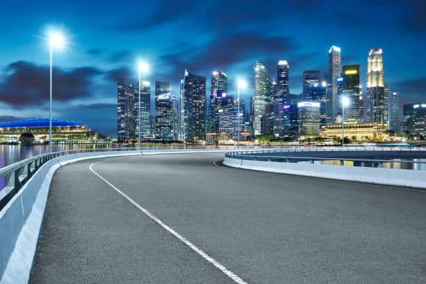
Expressways of Singapore
Introduction
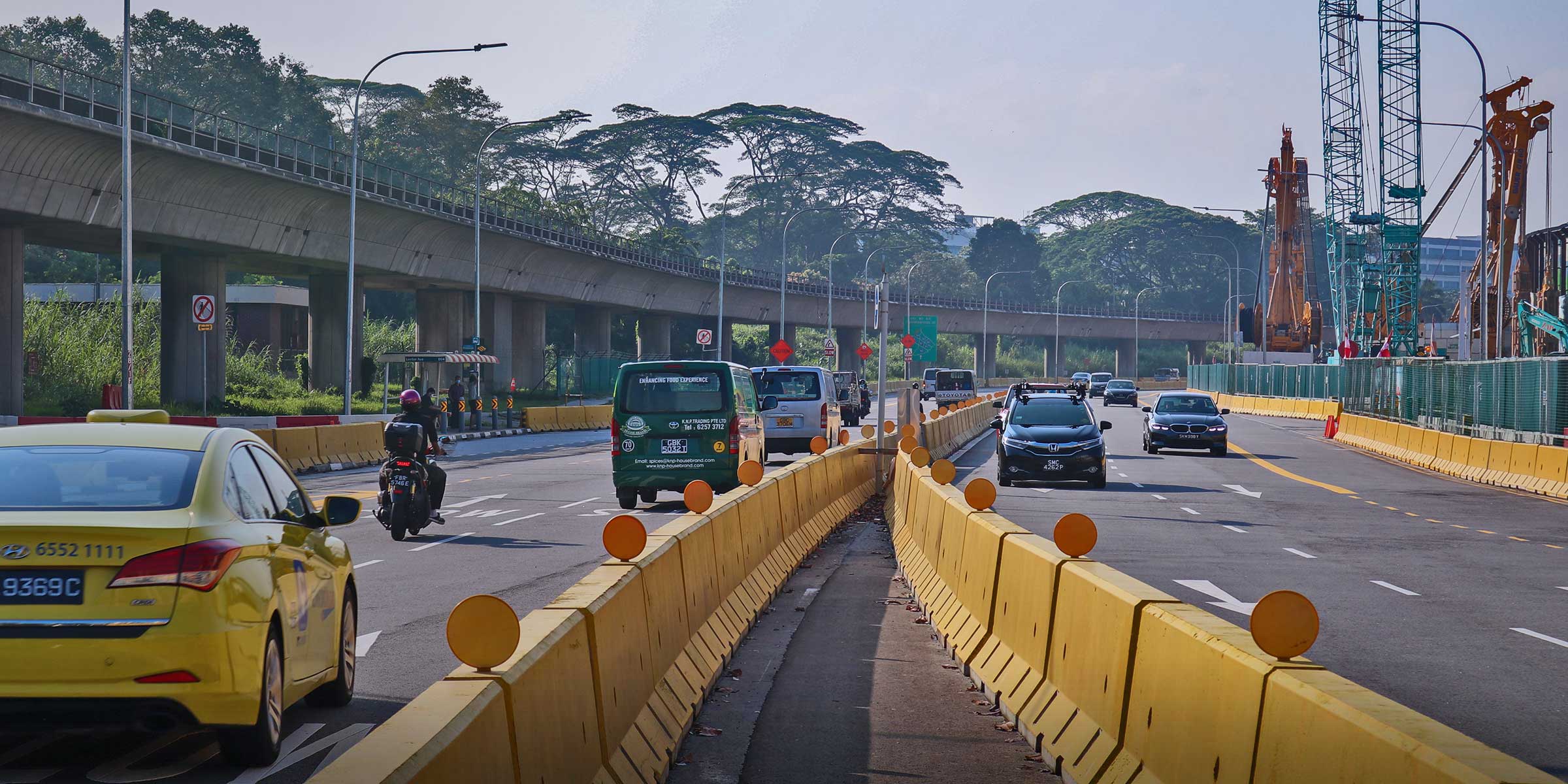
Along with the massive network of buses and trains that make public transportation, highways get also designed with car travelers in mind. And are that you will use one of the island’s ten versions of expressways if you are traveling, whether you are driving, using a cab, or renting a car. These broad, dual carriageways, which lack traffic lights and intersections, enable people to reach their homes, places of education, and workplaces more quickly and conveniently. They often feature three or more lanes in each way, and some even partially run below or underwater for quicker, shorter, and more links. Singapore’s open expressways have a 90 km/h maximum speed limit, and expressway tunnel have a default speed limit between 70 and 80 km/h. Drivers should adhere to expressway and tunnel road safety regulations and drive within the Speed limits.
What is an expressway in SG?
The expressways in Singapore are unique routes that enable drivers to move fast between urban areas. When work on the Pan Island Expressway started in 1962, the system’s construction was authorized. They are all two lanes with grade-separated access. Although some locations with five-lane carriageways and others with two-lane carriageway at expressway crossings, they typically have three to four lanes in each directional sign. Ten expressways exist. Ongoing research gets done to see whether more expressways are feasible.
In 1966, work on the Pan Island Expressway, the first expressway, began. There are 163 kilometers (101 miles) of expressways in Singapore as of 2014. Ayer Rajah Expressway (which links with the Second Link Malaysian expressway networks) and Bukit Timah Expressway are the routes that connect the Singaporean expressway networks and Malaysia (connects with the Johor Bahru Eastern Dispersal Link Expressway via Johor–Singapore Causeway).
How many expressways does Singapore have?
There are ten expressways now in use, totaling 160 km.
- Ayer Rajah Expressway (AYE)
- Bukit Timah Expressway (BKE)
- Central Expressway (CTE)
- East Coast Parkway (ECP)
- Kallang-Paya Lebar Expressway (KPE)
- Kranji Expressway (KJE)
- Marina Coastal Expressway (MCE)
- North-South Corridor (NSC)
- Pan Island Expressway (PIE)
- Seletar Expressway (SLE)
- Tampines Expressway (TPE)
Which is the first expressway in Singapore?
In Singapore, the Pan Island Expressway is the country’s first expressway.
The PIE gets first envisioned by the Public Works Department in the 1960s as a part of road extensions to handle escalating traffic signs, and construction on it began in 1964; Jalan Toa Payoh, the initial portion, was finished by 1969. In the 1970s, work on the expressway’s other sections gets completed. Jalan Boon Lay and the East Coast Parkway get connected by the first roadway, completed in June 1982. The PIE gets rerouted and extended west to Tuas between 1991 and 1993. The expressway could deal with a lot of traffic by the 1990s. In the 1990s and 2000s, the highway and the interchanges along its path widened to help with traffic congestion.
Which is the longest expressway in Singapore?
The Pan Island Expressway is Singapore’s longest expressway, measuring 42.8 kilometers (26.6 miles); the Tampines Expressway gets crossed by the expressway when it begins at a junction with the East Coast Parkway close to Changi Airport. It then takes a southwesterly bend, passing through Tampines, Bedok, and Geylang. It goes west and follows Toa Payoh’s southern border after crossing the Kallang-Paya Lebar Expressway and making a northwesterly bend. The expressway leaves Toa Payoh along the northern side of Bukit Timah, curving southwest to connect with the Bukit Timah Expressway and then turning west again at Clementi Avenue 6. The PIE travels along the northern borders of Clementi, Jurong East, and Jurong West before coming to an interchange with the Ayer Rajah Expressway at Tuas Road.
Background
The Planning Department and the Public Works Department (PWD) designed the PIE as a high-speed road to give drivers access to “quick and uninterrupted” trips between the city center and the satellite towns and industrial estates in the southern part of Singapore island. They consist of Kallang Basin Industrial Estate, Toa Payoh New Town, and Jurong Industrial Estate. There were no expressways on the island at the time. Instead, they used primary thoroughfares like Changi Road, Bukit Timah Road, Woodlands Road, and Geylang Road to get to locations outside the city center.
The PIE gets planned as the government creates a new long-term land use and transportation plan. It outlined the foundation for Singapore’s physical and infrastructure development when it was unveiled later in 1971 as the Concept Plan. A network of expressways was part of the plan to accommodate the nation’s expanding motor vehicle population, which by 1965 had reached close to 200,000 and got developing on average at a rate of roughly 80 new vehicles each day. The PIE and East Coast Parkway, two of Singapore’s first expressways, as well as their locations, were noted in the plan.
What is the difference between highways and expressways in Singapore?
The expressways and semi – expressways (highways) at the top of Singapore’s major road hierarchy connect new towns or the city region. Expressways are urban freeways with little to no intersections regulated by traffic lights and for high-speed automobile traffic.
Singapore currently has ten expressways, and the eleventh, the North-South Expressway (NSE), is anticipated to be finished in 2023. There are ten expressways: Ayer Rajah Expressway (AYE), Bukit Timah Expressway (BKE), Central Expressway (CTE), East Coast Parkway (ECP), Kallang-Paya Lebar Expressway (KPE), Kranji Expressway (KJE), Marina Coastal Expressway (MCE), Pan-Island Expressway (PIE), Seletar Expressway (SLE), and Tampines Expressway (TPE).
The semi-expressways in Singapore are known as highways; they get built with reduced speed restrictions and, in contrast to expressways, include traffic signal-controlled junctions along their itineraries. The long parallel Bukit Timah-Dunearn normal roads – and the Nicoll Highway, West Coast Highway, and Jurong Island Highway a components of Singapore’s semi-expressway network.
In reality, the Tuas Second Link Highway traverses the Straits of Johor between Tanjung Kupang in Johor and Tuas in Singapore.
The Public Works Department (PWD), which connected Upper Changi Road to the East Coast Parkway in the middle of the 1970s, also constructed the Bedok Highway. The name, however, only lasted a few years before Bedok South Avenue 1 was chosen as its replacement by the Committee on Street Names following discussions with the Housing and Development Board (HDB). Bedok Plain, Bedok View, and Bedok Walk were also given new names during the renaming process and are now known as Bedok South Road, Bedok South Avenue2, and Bedok South Avenue3, respectively.
What vehicle is not allowed on an expressway?
The following vehicles get prohibited from entering road tunnels and expressway tunnels following the Road Traffic Act and Road Traffic (Expressway Traffic) Rules:
- Transport with an overall height of 4.5 meters or more (including any load)
- The vehicle is more than 3 meters wide overall
- Automobiles with a length of more than 13 meters, including any load
- Trailer transporting a typical container;
- Truck hauling diesel fuel (e);
- Any vehicle with pedals designed to run entirely on human power; and
- Any bicycle with an electric motor can be moved forward either by human power, the electric motor, or both.
Also prohibited from using expressways, including the KPE, MCE, and CTE tunnels, are the vehicles listed below under the Road Traffic Act’s Road Traffic (Expressways – Excluded Vehicles) Rules:
- bicycles;
- tricycles;
- trishaws;
- motorized vehicles with sidecars attached;
- invalid carriages;
- three-wheeled vans;
- low trailers;
- road rollers;
- ready-mix concrete trucks;
- mobile cranes;
- forklifts;
- excavators;
- road pavers;
- tractors;
- dumpers;
- wheel loaders;
- bulldozers;
- graders;
- mobile concrete pumps;
- hydrant dispensers;
- Motor vehicles whose wheels get not equipped with either solid rubber tires or pneumatic tires;
- Any other motor vehicle’s top speed on any road, as permitted by the Road Traffic (Regulation of Speed) Rules, is 40 kilometers per hour.
Which is Singapore’s oldest expressway?
The Pan Island Expressway (PIE) is the oldest expressway in Singapore, built between 1964 and 1981, having first started in its construction by the Public Works Department (PWD) in 1966 as a means to link up the existing and new satellite towns and industrial estates between Toa Payoh and the Kallang Basin. From Mount Pleasant to Jalan Kolam Ayer and Paya Lebar Way, Whitley Road gets widened as part of this project.
Toa Payoh Flyover and Thomson Flyover were constructed in 1970 and 1971, respectively, and were part of PIE’s ongoing extensions in the early 1970s. A portion of Jalan Toa Payoh gets connected to the highway, and more than 1,700 tombs in Bukit Brown Cemetery had to get dug up to make room for the building project.
Between Jalan Eunos and Kallang Bahru, a segment of the highway was finished in January 1975, while Jalan Kolam Bahru, between Kallang Bahru and Woodsville Circus, was upgraded to become a part of the expressway. The PIE’s eastern segment, between Jalan Eunos and Changi Airport, gets built when the section between Adam Road and Jalan Anak Bukit opened in October 1976.
Whitley Road needed to have three lanes added in each direction, and work to build a grade-separated junction to connect it to the PIE began in November 1977. Between Adam Road and Whitley Road, a part of the highway was finished by 1978 and made accessible to vehicles in 1979. In 1978, construction on the PIE between Jalan Anak Bukit and Boon Lay Road also started. A $15.2 million viaduct spanning Upper Bukit Timah Road and Jalan Anak Bukit connects this portion of the PIE to the rest of the network.
Mr. Teh Cheang Wan, the then-Minister for National Development, ceremonially launched the $50 million-dollar PIE section between Jalan Eunos and the East Coast Parkway on January 10, 1981. Soon after, on January 31, 1981, Mr. Lee Yiok Seng, the then-mayor of Singapore, inaugurated the portion of the expressway between Upper Bukit Timah and Corporation Road. Soon after, on January 31, 1981, Mr. Lee Yiok Seng, the Parliamentary Secretary, officially opened the expressway portion between Upper Bukit Timah and Corporation Road (National Development). The PIE was completely operational in June 1982, three months ahead of plan, with the construction of two flyovers over Aljunied Road and Paya Lebar Road.
What is the shortest expressway in Singapore?
The Bukit Timah Expressway (BKE), Singapore’s shortest expressway, travels from north to south and connects Woodlands to PIE, finished in the middle of the 1980s. It directly links to the Woodlands Causeway at its northernmost point. The expressway connects to three additional expressways throughout its 11-kilometer journey in SLE, KJE, and PIE.
For Woodlands inhabitants who wanted to go to their businesses on the southern and western edges of Singapore, the opening of BKE—called BTE—at the end of 1985 brought great ease and accessibility. As it became simpler to access the new town from other areas of Singapore, the recently created Woodlands also saw an increase in popularity.
The expressway gets built with six-lane dual carriageway and seven flyovers, including the Woodlands Flyover, Mandai Flyover, Gali Batu Flyover, Zhenghua Flyover, Dairy Farm Flyover, Rife Range Flyover, and Chantek Flyover. For better connectivity with SLE, a portion of BKE gets upgraded into a four-lane dual-carriageway in 2003.
Ayer Rajah Expressway (AYE)
The Ayer Rajah Expressway runs from the Marina Coastal Expressway’s western terminus in the south of Singapore to Tuas in the west, close to the Tuas Second Link to Malaysia. To supplement the function of the Pan Island Expressway, it joins the Marina Coastal Expressway and the East Coast Parkway to create a second east-west link.
The AYE had a significant bus thoroughfare between Tuas West Drive and Alexandra Road. You may find the Biggest EMAS signboard between Penjuru Road and Clementi Avenue 6 and between Clementi Road and North Buona Vista Road. The previous EMAS signboard is between Lower Delta Road and Keppel Road. The AYE, which connects Tuas West Drive and the Pan Island Expressway, is an ideal route for traffic coming from Johor Bahru because it is the only expressway that connects to Second Link. The AYE travels along the former Overground transport corridor between Alexandra and Tanjong Pagar West stations.
Ayer Rajah and Upper Ayer Rajah Roads get upgraded to become a part of the new expressway, and the AYE project, which had a total length of 14 km at the outset, was completed in two phases.
After two years of contract bidding, planning, and building, the Keppel Viaduct, with its 60 spans, was finished in 1985. The Dual three-lane carriageways, 2.1 km long viaduct, which cost $60 million to build, was constructed to relieve Keppel Road’s traffic congestion, which reached nearly 3,000 cars during peak hours.
Bukit Timah Expressway (BKE)
The Bukit Timah Expressway in Singapore begins at Bukit Timah on the Pan Island Expressway. It continues north to the Johor-Singapore Causeway and the Woodlands Checkpoint. All of these projects and the development of Bukit Timah Expressway and Bukit Panjang New Town started in 1985.
History
The expressway gets built when bids for the project get announced on May 22, 1982. Beginning in 1983, the Pan-Island Expressway gets finished in two sections, the first from Woodlands to Mandai Road and the second from Mandai Road. Explosives were employed to clear the Bukit Timah area, through which the second part of the expressway ran, for construction because the region was hilly. Bukit Panjang Road, a new road, was opened from BKE to Woodlands Road during development, and new interchanges get also created at Mandai Road and Woodlands Road. Jalan Kwok Min, Lorong King kit, and Lorong Garpu get among the Kampong roads destroyed. A small portion of Jalan Kwok Min is still there, and the Singapore Armed Forces have controlled the neighborhood since 1997.
The LTA began constructing an eight-lane dual carriageway with four lanes on either side of the expressway in 2003, extending it from the intersection with the Kranji Expressway to the crossroads with the Seletar Expressway. Midway through 2005, this project gets completed And finishing this construction in the middle of 2005.
Central Expressway (CTE)
The CTE runs through various new towns in Ang Mo Kio, Bishan, and Toa Payoh as it connects the northern and central regions of Singapore to the city. It links to SLE and TPE in the north and AYE at the Radin Mas Flyover in the south.
Singapore’s PIE and ECP expressways get built by the middle of the 1980s. The initial stages of the construction of CTE, AYE, and BKE had already started. Seletar Expressway(SLE), Tampines Expressway (TPE), Kranji Expressway (KJE), and Kallang Expressway (KLE) were four additional expressways intended to connect the island’s main hubs of activity and allow for quicker travel. Nine expressways totaling 134km in length get intended to be a part of the expanded road network that would work in tandem with the new Mass Rapid Transit system (MRT).
Between Ang Mo Kio Avenue 1 and Thomson Road, the first phase of the CTE’s construction got underway in July 1981. A 3 km (1.9 mi) section of the expressway between Ang Mo Kio Avenue 1 and Jalan Toa Payoh and a portion of the expressway between Jalan Toa Payoh and Thomson Road were both opened in May 1985 to reduce the amount of traffic on Upper Thomson Road. A 3 km (1.9 mi) S$18 million portion of the highway in Ang Mo Kio began building in August 1985. The 1.7 km (1.1 mi) stretch between Ang Mo Kio Avenue 5 and Yio Chu Kang Road gets built between August 1986 and November 1988, and it opened to traffic in January 1987.
East Coast Parkway (ECP)
The East Coast Parkway is an expressway that runs along the southeast coast of Singapore; the expressway, which has a length of around 20 km (12 mi), links Singapore Changi Airport<span< a=””> style=”font-weight: 400;”> in the east with the Benjamin Sheares Bridge south of the main island. At the Changi Flyover, roughly one kilometer (0.62 miles) from the expressway’s eastern end, it also links to the Marina Coastal Expressway and has an interchange with the Pan Island Expressway. The third-longest highway in Singapore as of July 2022.</span<>
In contrast to other expressways in Singapore, the East Coast Parkway’s abbreviation finishes with the letter “P” for “Parkway.”
Previously, the AYE and East Coast Parkway get joined directly. But one expressway segment gets cut off after the Benjamin Sheares Bridge, and another stretch in the Marina South area was straightened and made into an arterial route. It was all due to the MCE opening on December 29, 2013, resulting in the truncation of those two sections. The expressway, along with the MCE and the AYE, could be Singapore’s southern east-west road.
After Xilin Avenue, the expressway turns to follow the coastline after initially traveling southeast from Changi Airport. After then, it travels along East Coast Park, passing via the Upper East Coast, Siglap, Marine Parade, and Mountbatten neighborhoods.
Following Exit 13 for Fort Road – Keppel Road (signaled 14A eastbound), the ECP turns farther inland, going via the interchange with the MCE and KPE before the Benjamin Sheares Bridge, which provides a stunning perspective of the city center. Still, on the bridge, the road turns to the south and enters the Marina Bay Area, passing Marina Bay Sands.
Kallang-Paya Lebar Expressway (KPE)
The third-oldest expressway in Singapore’s network is the Kallang-Paya Lebar Expressway (KPE)- the southern (Kallang) and final (Paya Lebar) sections of the expressway opened first on October 26, 2007, and September 20, 2008, respectively.
The six-lane (2×3) highway, which runs over 12 kilometers (5.3 miles) and connects the Tampines Expressway(TPE) in the northeast with the East Coast Parkway (ECP) in the south, will have 8.5 kilometers (5.3 mi) of main cut and cover tunnels when it built. It is the longest Subterranean road tunnel in Southeast Asia and gets constructed for roughly S$1.8 billion (USD$1 billion).
The KPE was reportedly the sixth-longest underground road project in the world. There will be eight interchanges, eleven on-ramps, and twelve off-ramps on the dual-carriageway expressway with three lanes in each direction. The Marina Coastal Expressway, which debuted on December 29, 2013, is also readily accessible from the south end of the KPE.
The Land Transport Authority (LTA) has awarded a contract for the new road connection to Punggol Road Central and the KPE/TPE interchange expansion at the north end of the expressway. It creates a more direct route to and from the KPE and TPE and reduces traffic congestion on the TPE between the current KPE ramps and Punggol ramps. Three new vehicular bridges crossing Sungei Serangoon and Sungei Blukar, a new flyover across TPE, and various related ramps are all part of the project’s design and construction; construction began in the second quarter of 2015.
Kranji Expressway (KJE)
KJE’s construction started in 1990 as part of the government’s strategy to transform Singapore’s northwest into thriving residential and commercial zones. The 8.4km-long expressway took around five years to build; several long dirt routes and certain kampongs in Old Choa Chu Kang, including Kampong Cutforth, had to be cleared. In March 1995, KJE finally made its debut.
Residents in Choa Chu Kang, Bukit Batok, Jurong, and Bukit Panjang had a more direct and convenient way to travel between Woodlands and the western part of Singapore thanks to KJE, which connects BKE and PIE. Gali Batu Flyover, Yew Tee Flyover, Choa Chu Kang East Flyover, Choa Chu Kang West Flyover, and Yew Tee Flyover are the five flyovers that KJE currently has.
Marina Coastal Expressway (MCE)
One of the expressways in Singapore’s network is the Marina Coastal Expressway (MCE), which development started in 2008 and finished at the end of 2013. The expressway gets formally inaugurated by Senior Minister of State Josephine Teo on December 28 of that year in the presence of Emeritus Senior Minister Goh Chok Tong. The next day, it was made accessible to vehicles.
The 5-kilometer (3.1-mile) MCE connects to the KPE’s southern terminus, its intersection with the ECP, and the eastern terminus of the AYE. It connects Singapore’s eastern and western regions to the Marina Bay area’s New Downtown, which is currently under construction.
With five lanes in each direction, the MCE manages the heavy commuter traffic brought in by the area’s offices, residences, and recreational attractions. Access is available to the current Marina South Pier and the Marina Bay Cruise Centre Singapore.
On March 9, 2006, plans to build the Marina Coastal Expressway, connect the KPE to the AYE, and help relieve traffic on the East Coast Parkway, get announced. Following the completion of feasibility studies for the new expressway, Transport Minister Raymond Lim declared on July 27, 2007, that the $2.5 billion project get given the go-ahead.
The new Marina Coastal Expressway (MCE) would be 5 kilometers long. The highway, which joins the East Coast Parkway, Kallang-Paya Lebar Expressway, Marina South Expressway, and Ayer Rajah Expressway, was completed on December 29, 2013, and it has Singapore’s first underwater tunnel.
North-South Corridor (NSC)
The North-South Corridor (NSC), formerly known as the North-South Expressway, is an expressway that is currently getting built and, when finished, will be the eleventh in Singapore’s network of expressways. Increasing traffic along the north-south corridor, supplied by the Central Expressway, will be accommodated by the North-South Corridor (CTE). When constructed in 2026, the 21 km (13 mi) highway, known as the North-South Corridor, will get roughly S$7-8 billion in cost and connect Singapore’s northern regions to the East Coast Parkway (ECP).
Woodlands, Sembawang, Yishun, Ang Mo Kio, Bishan, and Toa Payoh are just a few of the towns in the north-south route that will be connected to the city center by the NSC, which will feature a total of 16 entries and 17 exits. The Pan-Island Expressway (PIE), the Seletar Expressway (SLE), and the East Coast Parkway (ECP) will all have connections to the NSC (ECP).
Pan Island Expressway (PIE)
The Pan Island Expressway (PIE) is Singapore’s longest and oldest expressway; the road is also the longest in Singapore. The 42.8-kilometer-long expressway connects Tuas in the west to the East Coast Parkway at Changi Airport in the east (26.6 mi).
Singapore’s longest expressway, the Pan Island Expressway, is 42.8 kilometers long. Near Changi Airport, the expressway starts at a junction with the East Coast Parkway and travels northwest before intersecting the Tampines Expressway. Before crossing the Kallang-Paya Lebar Expressway and veering northwest, it arcs southwest, passing through Tampines, Bedok, and Geylang. From there, it turns west and follows Toa Payoh’s southern border.
The Bukit Timah Highway gets met by the Toa Payoh Expressway as the expressway runs along Bukit Timah’s northern border. At Clementi Avenue 6, the expressway turns back to the west. The PIE then passes via the north boundaries of Clementi, Jurong East, and Jurong West before a stop at Tuas Road, where it merges with the Ayer Rajah Expressway.
All Singaporean expressways, except SLE, are currently connected to PIE. The expressway also has the most flyovers, with 31 in total, including the Changi Flyover (linked to ECP), Upper Changi Flyover, Simei Flyover, Tampines South Flyover, Bedok Reservoir Flyover, Bedok North Flyover, Eunos Flyover, Mount Pleasant Flyover, etc.
Seletar Expressway (SLE)
The Seletar Expressway connects the Central Expressway (CTE) and Tampines Expressway (TPE) in Seletar to the Bukit Timah Expressway (BKE) in Kranji. It runs through the northern part of the island of Singapore.
The 12-km SLE gets constructed in two phases between 1992 and 1998 and links to the CTE in the Yio Chu Kang district, TPE at both ends, and BKE.
The SLE project gets completed in two phases: the first between Yio Chu Kang Road and Upper Thomson Road, and the more challenging second between its junction with the BKE and Upper Thomson Road via Woodlands and Mandai. The final section of the SLE gets constructed in 1998, and on February 22, 1998, Minister of StateJohn Chen Seow Phun officially launched the new expressway.
There are seven flyovers for SLE: the Yio Chu Kang Flyover, the Upper Thomson Flyover, the Upper Thomson Flyover over Woodlands South, the Ulu Sembawang Flyover, the Lentor Flyover, and the Woodlands South Flyover.
Singapore’s northern loop gets shut down after SLE gets completed in1998, marking the end of construction and the official start of the expressway system. For the citizens of Yishun, Sembawang, and Woodlands, this meant greater convenience.
Tampines Expressway (TPE)
The Tampines Expressway (TPE) connects the Pan Island Expressway (PIE), the 11th expressway, which is located east of Singapore Changi Airport, with the Central Expressway (CTE) and Seletar Expressway (SLE), located north of the island.
In the 1980s, the highway gets built in tandem with Tampines New Town’s growth. The highway’s first phase bid was on February 22, 1986. The existing sections of Tampines Road get widened beginning on August 5, 1986. The PIE to Elias Road segment of the highway saw its first day of operation on September 30, 1987.
Sembawang Construction and Hock Lian Seng Engineering get awarded the contracts for the second phase of the expressway on November 19, 1987. Beginning on December 24 and ending on May 30, 1989, work gets done on Phase 2 of the highway, which extends west from Elias Road to Lorong Halus.
The TPE was extended westward in the 1990s to connect with the CTE and SLE to service the more recent residential communities of Sengkang and Punggol and create a continuous expressway link between the island’s northern and eastern regions. With these extensions, a large portion of Lorong Lumut, Lorong Halus Village, Cheng Lim Farmway, Jalan Kayu Village, Lorong Andong, Lorong Anchak, and Boh Sua Tian Road get also acquired.